 Hoppa till huvudinnehållet

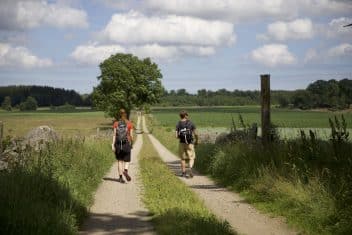
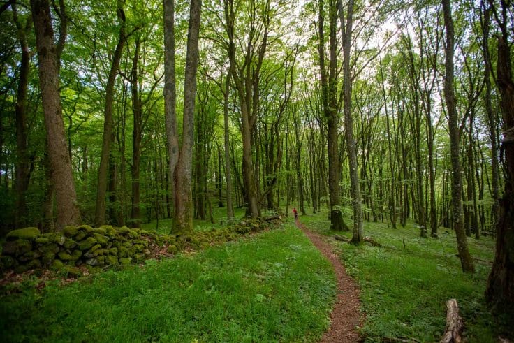
Hike in MittSkåne
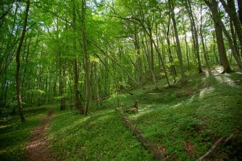
In the heart of Skåne there are 200 km of hiking paths and trails through varied nature, lakes and cultural history. For day hikes, for example, there are Fulltofta, Frostavallen and Rövarekulan with wonderful loops of different lengths. If you’re tempted by multi-day tours, combine great accommodation with several day hikes. You can also make your way along the Skåneleden North–South route or the Ridge-to-Ridge route through the area. Part of the pilgrim route Saint Olav’s Way runs from Harlösa to Hallaröd.
Hiking in Skåne – see all our hiking trails!
Fulltofta Nature Centre
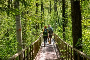
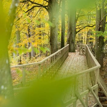
The Treetop Walk in Fulltofta
Allarps Bjär
Frostavallens naturreservat
Abullahagen Nature Reserve
Borstbäcken Nature Reserve

Eslöv Common Nature Reserve
Recreation area in Örtofta
Trollsjö area
Holma Forest Garden
Flyinge meadows nature reserve
Bosarps Järs Nature Reserve
Fulltofta walking area

Fulltofta
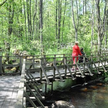
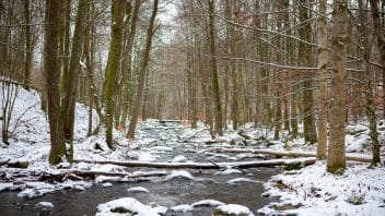
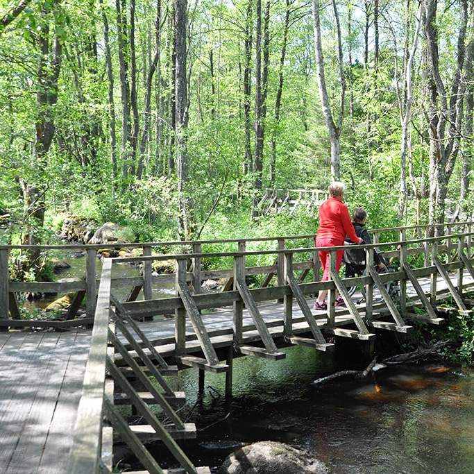
Fulltofta recreation area is a hiking paradise in the heart of Skåne between Höör and Hörby. The landscape is varied, with deep forests, open clearings and pastures, wide heaths with mighty oaks, small and large ponds and several small streams.
Here you’ll find Fulltofta Nature Centre with exhibitions about nature, a café, conference facilities and activities. The Skånska Landskap Foundation offers fourteen marked hiking trails here, up to about 15 km, but there are no cycling routes. The Skåneleden loop trail Uno’s Round also passes here. Several paths are accessibility-adapted for wheelchairs and strollers.
To avoid crowds on weekends and in peak season, choose to come by bus or park at the smaller car parks.

Frostavallen
Frostavallen recreation area is beech forests, shimmering lakes and open countryside. Beech forest dominates the area and in spring the ground is covered with wood anemones. Remains of old volcanoes and landslide cliffs can also be found here. Dagstorpssjön and Vaxsjön invite you to swim and play, and the area contains several exciting volcanic relics.
The Skånska Landskap Foundation and the municipality of Höör offer several marked hiking trails in the area, between about 3–10 km. Both the Pilgrim Trail and the Skåneleden pass through the area.

Mölleriket
Looking for cultural experiences as well as nature? Then you should hike in Möllerike – the area around Stockamöllan is fittingly known by that name. Stroller-friendly walking paths and beautiful, easy-to-access picnic spots share the landscape with twisty, hilly trails. Quarries and old mills that recall earlier times alternate with spruce and beech forest, meadows and grazing land on loops that range from a few kilometres up to nearly ten.
If you want to challenge yourself, choose the roughly 9 km Stone Quarry Loop. It’s more demanding than the other loops and therefore not stroller-friendly.

Tjörnarp
In the area around Tjörnarp you can hike through varied environments past the Himlaberget volcano. The landscape is hilly, with grazed and cultivated land mixed with forests and beautiful views over Lake Tjörnarpssjön. In the eastern parts, the old brickworks is a lovely place to visit. There are three hiking loops of 3–6 km and two nature reserves here. It’s easy to get here with the Pågatåg trains.
The Skåneleden also has a connecting trail from Tjörnarp station that takes you to Skåneleden SL2-6 between Lillsjödal and Frostavallen.

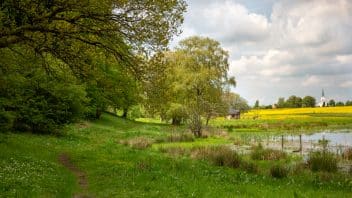
Ringsjön
Around Ringsjön there are several options for shorter walks.
Västra Bosjökloster nature reserve has a marked loop of about 3 km and runs right along Ringsjön. The trail starts at the car park and takes you into unique nature by western Ringsjön, past old oaks that have grown there since the 1700s. Stop by the barbecue area with views over the water.
Fulltofta Häggenäs is a popular but lesser-known part of the Fulltofta recreation area. Here you’ll find an accessible lakeside promenade that leads out to a bird-rich viewing platform. A new nature trail of about 1.5 km is also available to walk at Fiskarhus. A picnic spot with lake views is promised.
Storkhägnet is about 1 km from the car park. Here you can connect to the area’s longest hiking trail at 17 km.

Önneköp
In the area around Kölleröd and Önneköp there are designated loops suitable for both hiking and cycling. Best for hiking are Olofs (8 km) and Pickelhattakroken (7 km). Olofs takes you through natural environments rich in cultural remains. Pickelhattakroken takes you around near the Fjällmossen nature reserve, which is the southernmost refuge of black grouse. Both routes mainly follow a mix of asphalt and gravel along the gently trafficked roads east of Hörby.
In Önneköp there is a country store, places to eat and more. While you’re in the area, also take the opportunity to visit Östra Sallerup’s cultural centre and the 17th-century park.

Stehag
Rolling fields interspersed with oak groves and beech forests characterise the Stehag area. There are many easy walking paths to choose from here, the very most beautiful located in Gyaskogen. Start by taking the stairs up to Gyaberget, where, according to old legends, the troll-witch Gya resides.
If you then want to continue, there are loops to choose from ranging from just over one kilometre to four kilometres. The walks start from the end of Skogsvägen in Stehag. All loops are easy to walk and stroller-friendly, except the yellow loop which follows smaller paths that are often muddy.

Rövarekulan
Down in the deep ravine, Bråån winds its way through forested land. In the past, you could hear dance music and laughter from the valley on bright summer evenings. Today, you can instead enjoy the babbling stream and rich birdsong. The 2.5 km-long reserve has a great diversity of species.
In Rövarekulan nature reserve there are several paths to choose from. Two loop trails of a few kilometres are marked.

Örtofta
In the Örtofta area – around the villages of Örtofta, Väggarp and Toftaholm – there are several nice unmarked walking loops of up to 7 km. There is also a shelter here. All routes start from Örtofta station, where the Pågatåg trains stop.

Harlösa
Borstbäcken nature reserve lies 5 km east of Harlösa. Here the stream flows through a deep ravine covered in deciduous forest. It can be tricky to get around, but give it a try – there is much to discover in the stream and the lush woodland. You can also walk all the way around the reserve, which offers a hike of about eight kilometres.
Sankt Olofleden
Saint Olav’s Way stretches between Lund in the west and Sankt Olof in the east. The pilgrim trail passes through the southern parts of MittSkåne, past places such as Harlösa Church, the Borstbäcken nature reserve and Hjularöd Castle, where the Christmas calendar series “Mysteriet på Greveholm” was filmed.
Saint Magnhild’s Way
Between Hallaröd and Höör, there has been a pilgrim route for many years that is now part of the Skåne–Blekinge pilgrimage route. Here you pass Skåne’s midpoint. Along the way you also encounter Saint Magnhild – Skåne’s only saint – and follow her path through scenic forest areas, past her spring and Fulltofta Church. In Harlösa, Saint Olav’s Way connects.
Near Eslöv
Trollestigen is about 4 km northwest of the town of Eslöv. The trail starts at the grand Trollenäs Castle. This marked trail is about 3.5 km and takes you past grazing horses and along the winding waters of the Saxån.
If you visit Eslöv and want to get out into nature, Snärjet is the closest area. It is an old, forest-planted heathland 2 km east of Eslöv station. There are no marked trails or loops in the area, but there are plenty of old forest roads to walk on.
Info about Eslöv’s nature reserves and natural areas
Near Hörby
Skåneleden SL2-9 between Bjeveröd and Hörby Ringsjöstrand (17 km) skirts the northern part of Hörby town in the Hörby fälad reserve. The stage follows paths through woodland recreation areas and passes Fulltofta Naturcentrum with exhibition and café. Boardwalks lead you out into otherwise inaccessible areas, and an abandoned railway embankment guides you past open fields.
9 Bjeveröd – Hörby Ringsjöstrand (skaneleden.se)
Hörby fälad is a nature reserve close to town, within walking distance just northwest of Hörby. The Skåneleden (SL2 North to South, stage 9) passes through the reserve, and there are also other small paths that take you around the heath. Parking is available at Hörby sportcenter right next to the reserve. The nearest bus stop, Magistergatan, is in Hörby about 1 km from the reserve.
Råby hällor is a nearby nature reserve with meadows, grazing land and mixed deciduous woodland crossed by two ravines. It is rich in ancient remains and contains, among other things, traces of old farmland, clearance cairns and a cup-mark stone. In the northern part, a walking path runs through the area.
Near Höör
Near Höör there are many opportunities for hiking.
Orup recreation area, 3.5 km south of central Höör, has five marked, walk-friendly loops. The loops are up to 5 km and take you through beautiful forests and past Orup’s old sanatorium with grand doctors’ villas and forgotten gardens. There is also an MTB trail here.
In Stenskogen, 5 km south of Höör, there are four marked hiking loops. The loops are up to 5 km and start from Backagården. Here there is fascinating cultural history and interesting landscape formations shaped by the stonecutters of the past.
In Fogdarödsskogen, 2.5 km east of central Höör, there is a marked loop. The loop is 5 km and is easy to get around both walking and running. The nature is varied, exciting and partly hilly.
The Brottets Bana trail starts about 1.5 km south of central Höör. The 3 km trail stretches through beautiful nature between Höörs Mölla and the Stanstorp stone quarry in Stenskogen. The hike is easy to moderately difficult and follows the old narrow-gauge railway.
Brochures with a map are available in a mailbox next to the information board at Höörs Mölla.
Flyinge
Right next to the residential streets lies the Flyinge ängar nature reserve with blooming sandy hills and the Kävlingeån’s moist riverside meadows. Here, local farmers have cut hay and grazed livestock for hundreds of years.
Allarps bjär
North of Hallaröd, Allarps bjär rises above the surroundings – one of several basalt hills in central Skåne, remnants of ancient volcanoes. It is a nature reserve consisting of one of Skåne’s most valuable deciduous forests. The Skåneleden passes through the reserve.

Bosarps jär
Bosarps jär nature reserve is a ridge about 3 km long, formed by meltwater from the inland ice. By the road towards Hemmingsberga there is a rest area from which you can climb up to the ridge via a staircase and walk along a small path.
Skåneleden North to South
The Skåneleden North–South route has stages 6–12 through MittSkåne. You enter from the north at Frostavallen. You are close to settlements, yet they are hardly noticeable. You then head east into the northern part of Fulltofta at the Bjeveröd ponds. In Fulltofta, Uno’s loop trail is 10 km. If you continue hiking, you might catch the sunset at Ringsjön. Continue southwest and through the enchanting Rövarekulan. After passing Hjularöd Castle, you reach Harlösa and can continue south towards Krankesjön.
Skåneleden Ridge to Ridge
Skåneleden SL3 Ridge to Ridge passes through MittSkåne via stages 7–12. You can reach MittSkåne from Söderåsen National Park via the volcanic remnants in the Allarps bjär nature reserve. You then hike through Frostavallen to the Fulltofta recreation area, past the mythical Onsvala spring and Fulltofta Nature Centre. From here you head east along the southern side of the Linderödsåsen ridge, where settlements are sparse. When you reach Rebbetuaröd, you have left MittSkåne and are beginning to approach Österlen.
In the Fulltofta recreation area there are three paths adapted for accessibility: The Ravine Loop / Tree Walk near Fulltofta Naturcentrum, Fiskestigen at the Bjeverödsdammen pond and the lakeside promenade at Ringsjön.
In the Frostavallen recreation area there is a 3 km loop with compacted gravel around Lake Vaxsjön.